Bus Information & Kiosk Program Systemwide
Gill Fishman Associates, 1985
Description
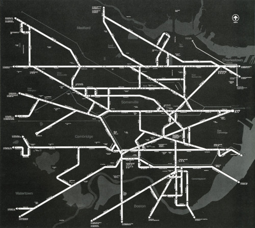
The task was to conceptualize, design and develop the materials for a major new public information program aimed at improving riders’ perceptions of bus availability, user routes, and route availability.
The solution was a three-year program, encompassing the entire MBTA bus system of 200 routes. The system has been divided into eight major regions, each having its regional map showing all roads that have bus routes, major roads as landmarks, rapid transit interfaces with the bus system, and important points of interest such as parks, schools, and social service offices.
Each regional map includes all routes within that region, a key to the regional system, a ‘how-to-use-this-map’ guide, and transit pass information.
Each map is keyed visually and by text to adjoining maps for user ease of legibility.
Street kiosks will contain porcelain enamel versions of the maps; all buses will carry printed paper maps for distribution.
Our scope of services included all programming, creation, and interpretation of data base maps, design, production and supervision of all materials.
Kiosk structure phase included all working drawings and specifications for public bidding.
Credits
- Design firm
- Gill Fishman Associates
- Art director/designer
- Gill Fishman
- Client
- Massachusetts Bay Transit Authority