Animated Maps
WGBH, Boston, Massachusetts, 1995
Description
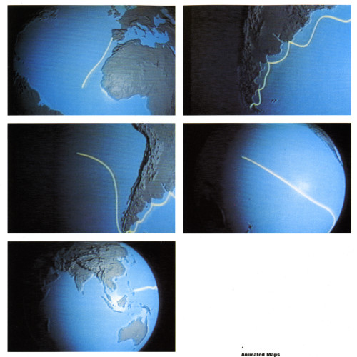
WGBH, Boston’s public television network, developed a six-hour documentary that relied heavily on mapping to depict the voyages of Columbus and the subsequent explorers who circumnavigated the globe. This sequence describes Columbus’s second voyage to the West Indies, which was then thought to be the edge of Asia. Rich, fluid 3-D computer animation articulates the adventurer’s path through the island chain and reinforces a global perspective while breaking with the pre-Columbian flat earth paradigm.
Collections:
Information Graphics: Design of Understanding
Repository:
Denver Art Museum
Discipline:
Information design
Format:
3D digital, Animation, Map
Credits
- Design firm
- WGBH
- Executive producer
- Zvi Dor-Ner
- Project director
- Bob Born
- Art director
- Chris Pullman
- Designer
- Chris Pullman
- Animator
- Lamb & Company
- Writer
- Various
Loading...
Loading...