Hammond Atlas of the World
Pentagram Design, New York, New York, 1995
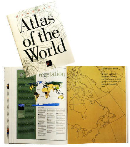
Description
This atlas is the result of an ambitious five-year effort that combined designers, mathematicians, cartographers, editors, and advances in digital technology. Using a new formula based on fractal geometry, maps were created by plotting the Earth’s latitude and longitude in a giant database. Because experimental departures from cartographic tradition would have obscured the information and undermined the maps’ credibility, the designers developed a strict system for type and color usage. They gave information graphic form in the front sections, which describe the world’s languages, religions, and environmental concerns.
Collections:
Information Graphics: Design of Understanding
Repository:
Denver Art Museum
Discipline:
Information design
Format:
Book, Information graphic, Map, Chart
Credits
- Design firm
- Pentagram Design
- Art director
- Michael Gericke
- Designers
- Donna Ching, Sharon Harel
- Map/chart designer
- Hammond, Inc.
- Writer
- Frederick Shamlian
- Publisher/client
- Hammond, Inc.
Loading...
Loading...