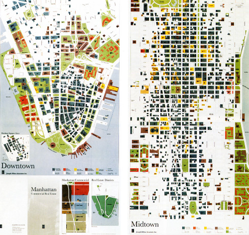
Manhattan Commercial Real Estate Map
Tsang Seymour Design, New York, New York, 1995
Description
Designing a map that describes the commercial real estate districts of Manhattan requires a critical appreciation of scale, ease of use, and graphic as well as textual legibility. After the designers determined the map’s scale and size (both open and folded), the principal communication device became color. Key colors are linked to prime available areas, while typographic fonts and sizes create distinctions between various information categories. An economy of descriptive devices and a focus on design fulfilled the client’s request that the map serve a dual purpose as a functional tool and a framed image.
Collections:
Information Graphics: Design of Understanding
Repository:
Denver Art Museum
Discipline:
Information design
Format:
Information graphic, Map
Credits
- Design firm
- Tsang Seymour Design
- Creative directors
- Patrick Seymour, Catarina Tsang
- Designers
- Patrick Seymour, Catarina Tsang
- Illustrator
- Microcolor
- Photographer
- Patrick Seymour
- Printer
- Tanagraphics, Inc.
- Paper
- Mohawk
- Client
- Joseph Hilton Associates, Inc.
Loading...
Loading...

