Schuykill Expressway Improvement Project Guides
Katz Wheeler, 1985
Description
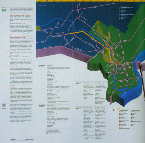
After a complete resurfacing and major reconstruction of Philadelphia’s only major arterial connection to its western suburbs, this three-year project has required major adjustment and patience by the Expressway’s half-million commuting users and its sizeable visitor population. Two brochures—one each for commuters and visitors—have been developed for the first two years of the project. Each is scaled and positioned to its audience’s needs: commuters are used to getting on and off at specific ramps, and need precise detouring information from point to point; visitors come from a much wider radius, but for the most part have a very narrow range of destinations, and so can be served by a single, wide area map. In all cases, a quasi-geographic, floating scale base is used; it gives the illusion of geographic accuracy while permitting distortion of scale to accommodate complex information where it is dense and to compress geography where the information is sparse. The folding system in the 1986 commuters’ guide makes it virtually impossible to misread the relationship between detour description and map.
Credits
- Design firm
- Katz Wheeler
- Art director/designer
- Joel Katz
- Typographer
- Duke & Co.
- Printer
- Intelligencer
- Writer
- Lois Morasco
- Client
- Pennsylvania Dept. of Transportation


